
For most people, visiting Antarctica is a dream come true.
We are not the exception. We planned our trip two years ago, but unfortunately, due to the pandemic, we have no choice but to postpone our trip until this year.
So once our country's border was opened a few months ago, we immediately planned our Antarctica trip.
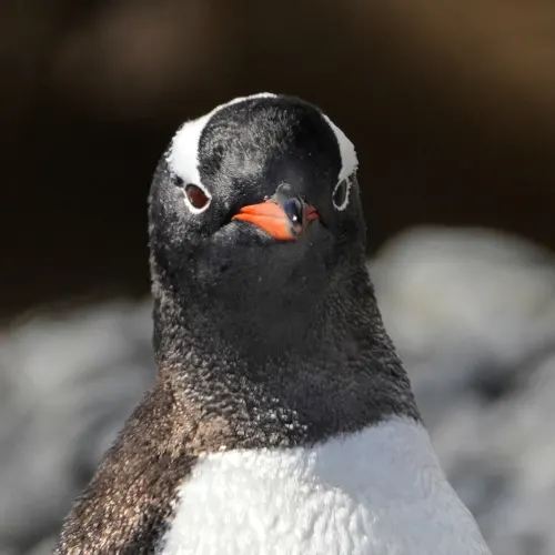
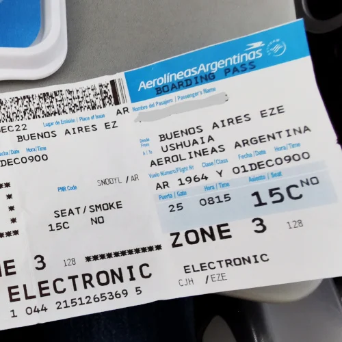
On 28th November this year, we finally boarded our plane, heading to Ushuaia, the southernmost town in the world. That is where we were onboard our expedition cruise to visit Antarctica.
There are many references about visiting Antarctica on the Internet. So, I will present our entire trip to Antarctica based on our first-hand information.
We managed to visit most of the places on our itinerary. However, there are various locations where you can visit Antarctica. Depending on weather, location, and itinerary, we have visited places that are among the most common for Antarctica trips.
Note: We have written an article about what to pack for the Antarctica trip. The packing list is different from other trips. It is an extensive packing list based on our experience.
Please read and download the packing list should you want to visit Antarctica.
Day 1 at Antarctica
We took two days to fly to Argentina and another two days to cross the Drake passage before our first landing in Antarctica. After that, I will write other articles, including our Drake passage crossing and life on an Antarctica cruise. Meanwhile, I would take the first day of landing in Antarctica as day one in this article.
Unexpectedly, our ship had to turn back to do a medical evacuation after a quarter of the way across the Drake Passage out of necessity. So we turned around, returned to the Beagle Pilot Station, and headed south again. Our Captain had to catch up with the schedule with all four generators running at top speed to quickly get across the Drake passage with every ounce of power.
Penguin Island

We passed the Nelson Passage at the South Shetland Islands, turned up to King Geoge Island, and successfully had our first landing at Penguin Island in the afternoon.


We got off our Zodiac and stepped into the shallow water. It was hard to land with those giant round boulders.
Penguin island is a small island offshore of King George Island. It is an ice-free oval-shaped island 1.6km long. The site's prominent geological feature is a 170-meter-high cone of Deacon peak, the northern face of which slopes gently down to the landing beach. Low cliffs surround most islands, and Crater Lake is in the northeast.
It is a volcano island, and Penguin island is the top third of the volcano. Some of us had hiked up the peak, where there was a panoramic view of the summit crater.
We chose not to hike. The chinstrap Penguins near the shore instead attracted us.

And enjoy the magnificent vista over the ice field of King George Island.
We watch the chinstrap Penguin atop the rounded basalt boulders.


Chinstrap Penguins negotiating the basalt boulders on the shores

Besides that, we spotted a few Adelie Penguins.

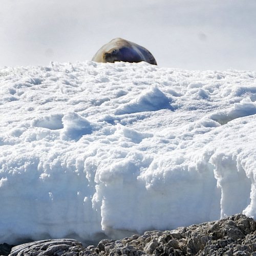
And the lazy elephant seals sunbathing on the shore.
The island is not covered by ice, as I pictured before the trip. Now I realize that Antarctica is not all about ice and snow. Volcanic eruptions from numerous islands here.

We sailed at night to Bransfield Strait and headed to the second-largest Island of South Shetland, Livingston Island.
Day 2 at Antarctica
We had our Zodiac cruise to Walker Bay and Hannah Point of Livingston Island the following day.
Livingston island
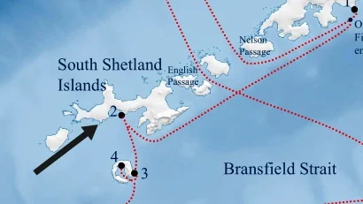

We did not land on Livingston island because it was low tide, and the shore has plenty of Penguin colonies which should not be disturbed. So instead, we took a Zodiac cruise along the coast.

Some big elephant seals were burbling and growling at Walker Bay.
Our Zodiac brought us to Hannah Point, where we saw almost all the bird species we expected to see at the Antarctic Peninsula, which was nesting and visible. The most visible ones were the Penguins colonies and the Southen giant petrels.


Among the birds that make their home here are the Gentoo, macaroni penguins, and kelp gulls. Southern giant petrels and snowy sheathbills.
Deception Island

So our ship left Hannah Point and headed the Deception Island.
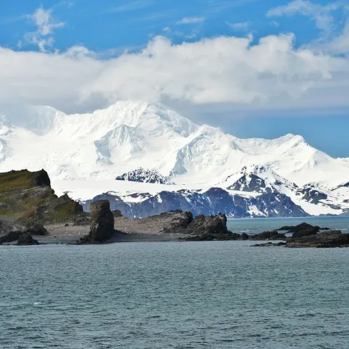
We did a quick sail by Baily Head, successfully entered Neptune's Bellows, and finally landed on the beach of Telefon Bay in the afternoon.
Telephone Bay is a small Bay surmounted by Telephone Ridge. Today's weather was perfect, with excellent visibility.
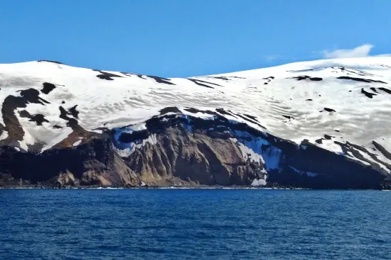
We walked up the crater rim of the caldera. From here, we could see Neptune's Bellows from the top.
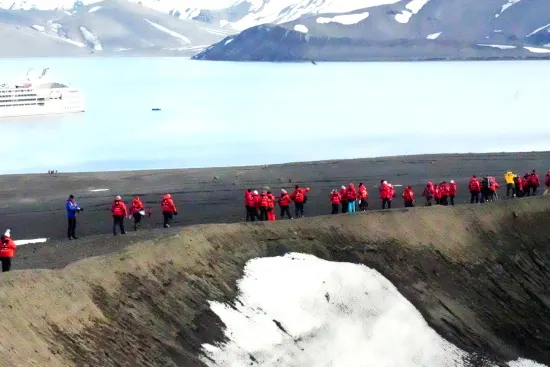
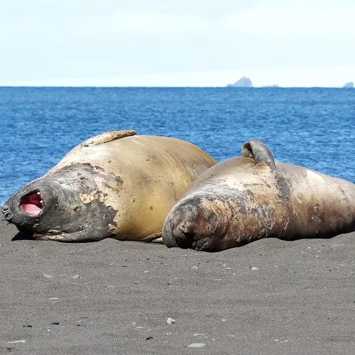
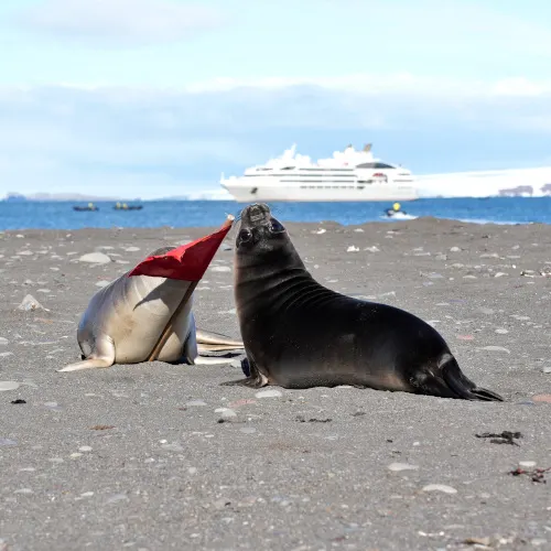
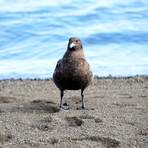
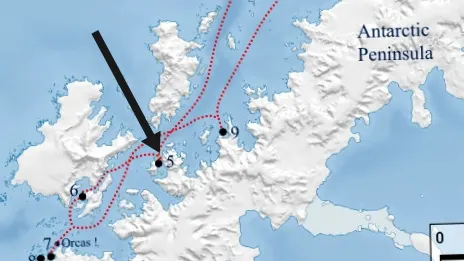
Deception island is in the South Shetland Islands close to the Antarctic peninsula, with a large and usually safe natural harbor, which is occasionally troubled by the underlying active volcano.
This island is the caldera of an active volcano, which seriously damaged local scientific stations in 1967 and 1969.
The first authenticated sighting of Deception Island was by the British sealers William Smith and Edward Bransfield in January 1820. However, it was first visited and explored by the American sealer Nathaniel Palmer on the sloop Hero the following summer, on November 15th, 1820. Palmer named it Deception Island because of its outward deceptive appearance as a typical island when the narrow entrance of Neptun's Bellows revealed it rather be a ring around a flooded caldera.
Watch our video- Penguin Island, Livingston Island & Deception Island 👇👇
We also shot a video during our excursion. You can view it on YouTube by clicking the image below.
Day 3 at Antarctica
We sailed into the Bransfield Strait to see the proud Gentoo Penguins of Cuverville Island.
The weather was excellent on day three. It was sunny and non-windy, and the temperature was about 5 degrees Celsius. Our expedition team helped us successfully land on Cuverville Island and Dorian Bay.
Some of the guests also had their first kayaking experience in Antarctica.
Cuverville Island
Our Zodiac landed at Cuverville Island in the morning, and along the way, there were plenty of icebergs.
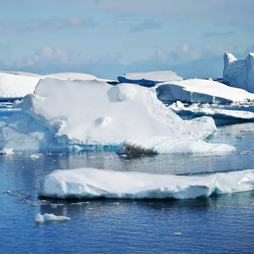
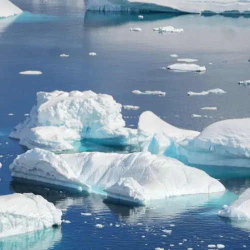
Numerous icebergs are often found in this area, making the water around this island an ideal place for Zodiac cruising.


We had to hike up in the heavy snow. The snow was deep, and we were asked to stay on the path and spend quality time with the Gentoos.

Cuverville island is a dark rocky island lying in the Errera Channel. This island has been identified as an important bird area because it has breeding colonies of about 6500 pairs of Gentoo Penguins.
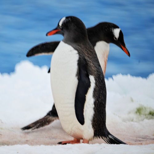
Dorian Bay

We crossed the Gerlache Strait in the afternoon and went into the Lemaire Channel. That slowed us down, and we had 45 minutes delay in getting to Dorian Bay of Wiencke Island in the afternoon.
The snow at Dorian Bay was gigantically high. The expedition team worked hard to make a path to get up onto the snow.

We could walk up to see the Damoy Hut from the outside. There are few structures erected on the shore of Dorian day in 1957. The larger building was known as Damoy Hut in 1975. The Hut is the most modern of Britain's historic sites and monuments in Antarctica. The hut acted for several years as the British summer air facilities and transit station for scientific personnel traveling further South to scientific stations.


Then we walk up to admire the view over the Lemaire Channel.

Dorian Bay is a Cove on the northwest side of Wiencke Island and east-northeast of Damay Point in the Palmer Archipelago of Antarctica. It was discovered by the French Antarctic expedition, from 1903 to 1905, under Jean-Baptiste Charcot and named by him after Monsieur Dorian, a member of the French Chamber of deputies.
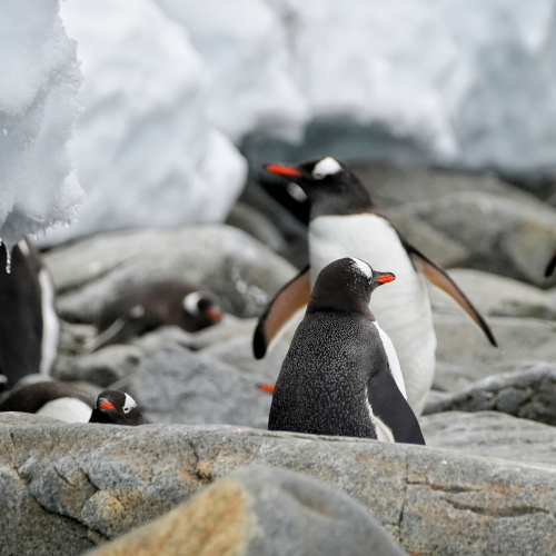
Watch our video- Cuverville Island and Dorian Bay 👇👇
Below is the video we shot at Cuverville Island & Dorian Bay. You can view it on YouTube by clicking the image below.

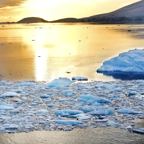
The icily scenic Lemaire Channel

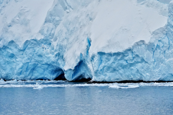
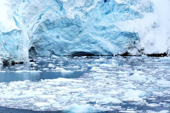
The channel has since become a standard part of the itinerary for cruising in Antarctica; not only is it scenic, but the protected waters are usually as still as a lake, a rare occurrence in the storm-wracked southern seas, is beautifully photogenic and wonderfully calm.
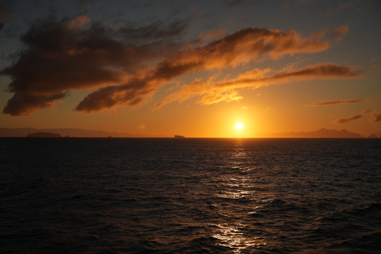
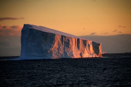
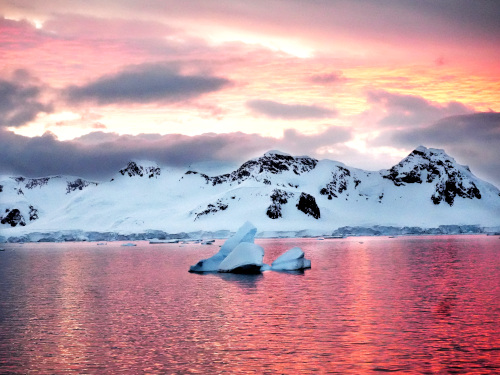
It is an iceberg-filled passage surrounded by towering ice cliffs and as still as a mill pond due to its relative protection from the seas.



Day 4 at Antarctica
Our ship sailed overnight at the Gerlache Strait and arrived at Portal Point. Unfortunately, the Captain informed the expedition team that he could not approach Portal Point as there was too much ice. So we switch the day around to the nearby Wilhemina Bay and as far as Bancroft Bay to have our Zodiac cruise.
Wilhelmina Bay / Bancroft Bay

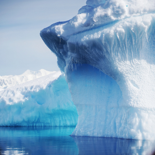
For a good reason, Wilhelmina Bay is high in the ranks of must-see Antarctic sites. The sheer ice clips and glacier sculpturing epitomized much of the entire experience. Its water is also shelter, enabling our Zodiac cruises between the islands and icebergs.


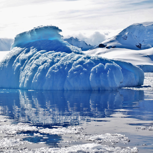
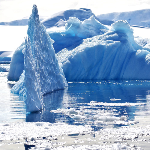
The sea was calm and beautiful, with gorgeous icebergs.




Watch our video- Wilhelmina Bay and Lemaire Channel 👇👇
We also shot a video during our excursion. You can view it on YouTube by clicking the image below.
Spert Island

In the afternoon, we were approaching Trinity Island, and we could see how exposed Trinity Island and Spert Island were.
Spert Island is an island lying off the western extremity of Trinity Island in the Palmer Archipelago of Antarctica.

The motion from the Drake Passage comes right in, but it was still calm enough to do a Zodiac cruise at Spert, which was the highlight of our trip.
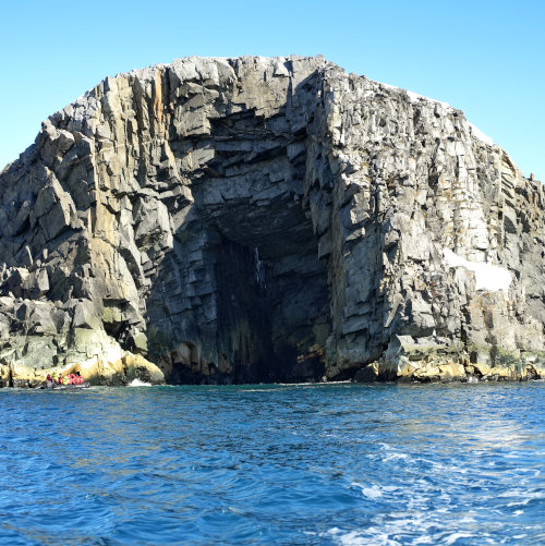

The sea was rough, and we sailed through the narrow passages and caves we didn't expect to see in Antarctica.


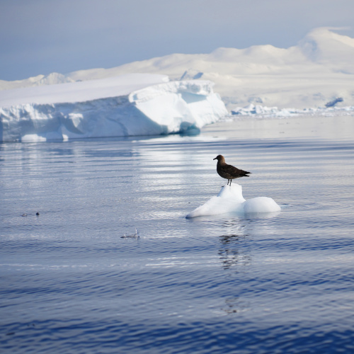
There was some iceberg floating around, And solitary penguins and birds were all occasionally sighted on the rocks.
With that, we sailed up the Bransfield Strait at night, covering a distance to get to the Antarctic Sound to make a landing the next day at Brown Bluff.
Day 5 at Antarctica
Brown Bluff, Antarctic Sound, Fridtjof Sound

Brown bluff is home to over 20,000 breeding pairs of Adélie Penguins as well as a small colony of Gentoo Penguins.

A long line of Penguins walked along the beach to the preferred location to get into the water away from areas where Leopard Seals may be hiding.

Some of us walked along the beach to observe the penguin swimming and jumping into the sea.
We spent time with the Adélie and the Gentoo penguins.

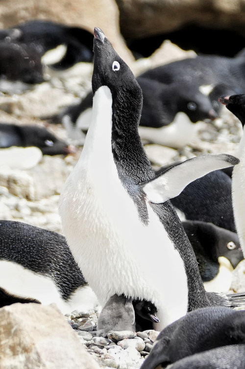
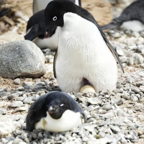

Brown Bluff is an excellent example of a tuya, a volcano flattened by erupting through a glacier! These are the rarest volcano types and are only found in areas that have been large-scale glaciation in the past.

With its distinctive tabletop look, Brown Bluff lies on the Tabarin Peninsula, the northernmost most of the Antarctic Peninsula.
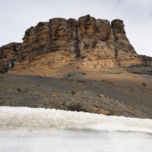
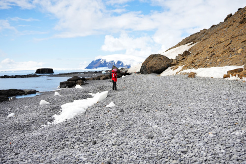
The landing beach here is made of pebbles and volcanic ash, rising quickly towards steep reddish brown clips.
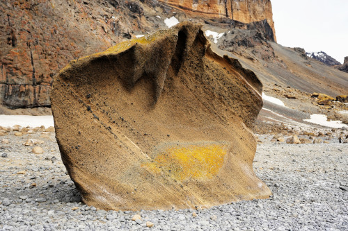
The cliffs are embedded with volcanic bombs, large pieces of lava that will turn out during an eruption, cooling in the air to land in solid spherical or oval shapes.
Antarctica Sound, Fridtjof Sound

After Brown Bluff, our ship sailed to Fridtjof Sound with beautiful ice. It took about an hour and get into the Weddel Sea.

There are plenty of icebergs in this area. We could view the icebergs floating slowly away at the observational deck of our ship.
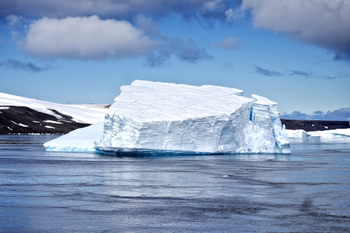
Over here, the Captain diverted to the west to get close to the ice.
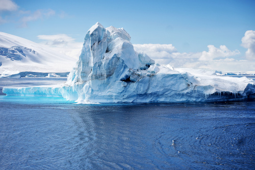
And back to the Antarctic Sound to see the tabular ice.

We then crossed Bransfield Strait, took the more challenging navigation of the English Passage, and headed across the Drake Passage towards Ushuaia.
Conclusion
This is the story of the voyage of Le Lyrial, our cruise. The total distance we traveled was 2210 nautical miles from Ushuaia to Antarctica, then back to Ushuaia.
We hope you enjoy our Antarctic voyage and the stunning images we took. We returned to Ushuaia through the Drake Passage again. We will have other articles about life on our cruise and how we survived the Drake Passage. Click to find out what you expect when you are there!

Gek tee
Tuesday 20th of December 2022
A very thorough and well documented journey , both interesting and educational.
Lily Teh
Tuesday 20th of December 2022
Epic! Awesome! Love the iceberg pics. Thanks for sharing a part of your Antartica trip - an eye opener to this part of the world which we might not be able to get a chance to visit. Looking forward to more of your videos and pics.👍👍👍
Freida
Monday 19th of December 2022
Thanks for sharing! Enjoyed meeting you both on this truly incredible journey which you have perfectly captured in this story and video.
kwankp
Wednesday 21st of December 2022
Great to meet you at the white continent. There will be a few more blog posts and videos to come. Stay tuned :)