Bukit Gasing is one of the most popular hiking destinations in Kuala Lumpur. Ever since I became hooked on hiking, I've visited the Bukit Gasing hiking trails countless times over the past six to seven years. During these frequent hikes, I've grown familiar with its various trails and hidden paths, a great place for nature lovers.
In this article, I’ll share a detailed guide based on my firsthand experience navigating in Bukit Gasing Forest Park. Since this is a long read, I’ve divided it into sections for easy reference. Click the links below to jump directly to the part that interests you most.
List of Content: Bukit Gasing Hiking Trails
- The Entrances
- Places of interest inside Bukit Gasing
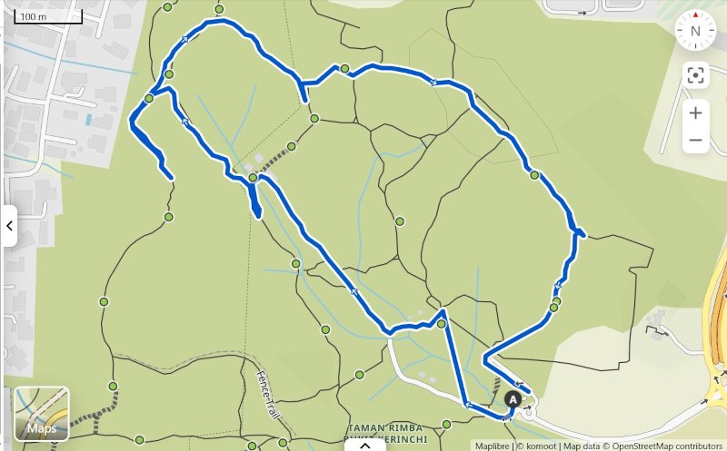
- Popular trails
- Facilitites
- Things to bring for the hike
- Best Time to Hike at Bukit Gasing
- Will There Be Any Animals?
- About Bukit Gasing
- 🎞️ Watch our video at Bukit Gasing
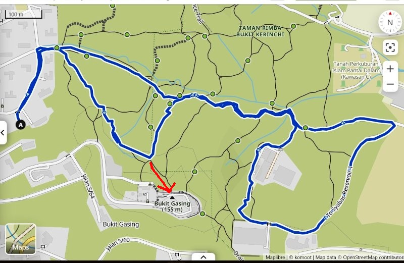
1. The Entrances of Bukit Gasing Hiking Trails
There are many entrances to the Bukit Gasing Forest Reserve because the hill is not fenced, allowing anyone to enter from any location. But there are a few established entrances that most people will use. Here is the list of the major entrances to Bukit Gasing Park:
a. The Main Bukit Gasing Entrance - The Archway (GPS: 3.095368, 101.656155)

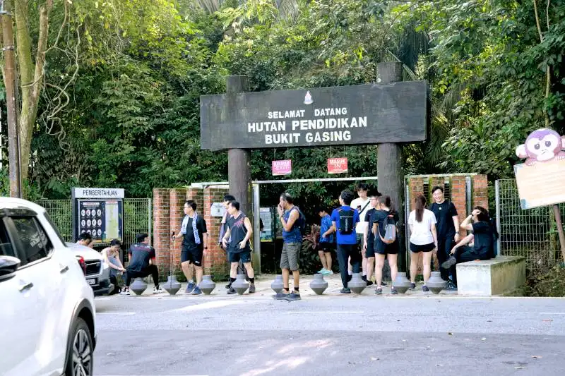
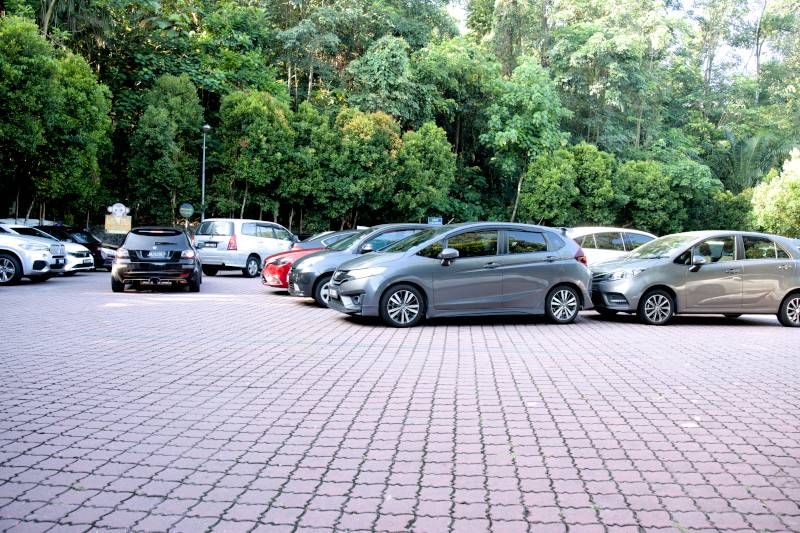
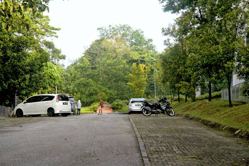
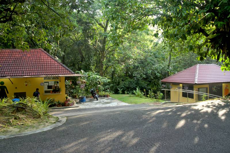
This is the most popular entrance located off Jalan Gasing, which was refurbished in July 2023. This entrance has the advantage of a parking area located about 100 meters away, on the right side when facing the entrance. The parking area also has toilets, so you can use them before entering the hill for hiking.
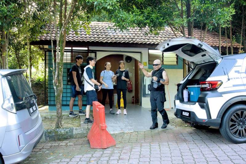

The only problem with this entrance is that the parking area is quite small, so there's a high chance you may not get a parking spot if you arrive late or on weekends. Fortunately, you can park along the road in front of the entrance, as long as your car does not cause any obstruction.

Besides this, there is also an area where you can wash your hiking shoes after hiking (in front of the toilet). This is a thoughtful facility, especially during the monsoon season when the trails can get muddy.
b. Pantai Hill Park entrance (GPS: 3.103800, 101.661053)
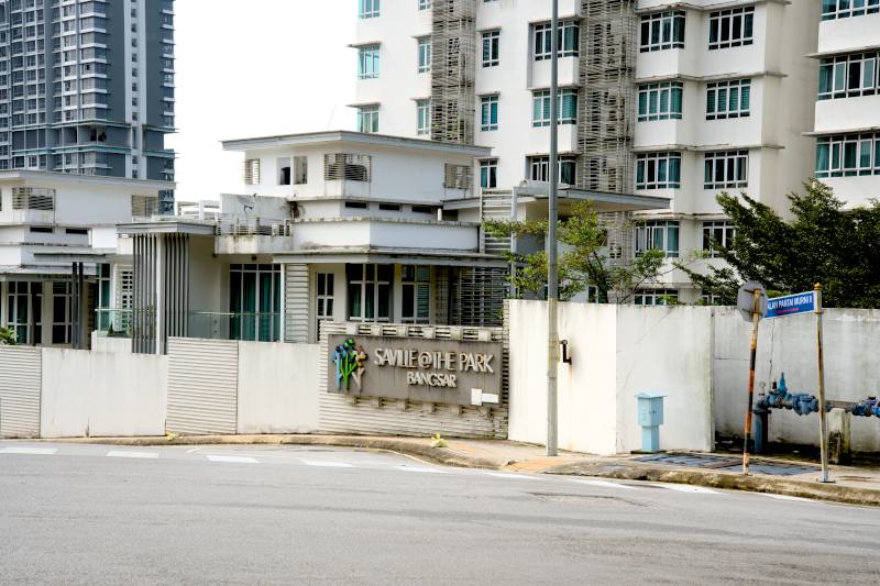
Another entrance is from Pantai Hill, Petaling Jaya. The trail starts at the opposite side of the road, right in front of Saville @ The Park, Bangsar. It is not an official entrance and is just a small Bukit Gasing trail that starts from the roadside. There are plenty of official parking spaces along the road leading to the trail.
Being an unofficial entrance, there is no toilet here.
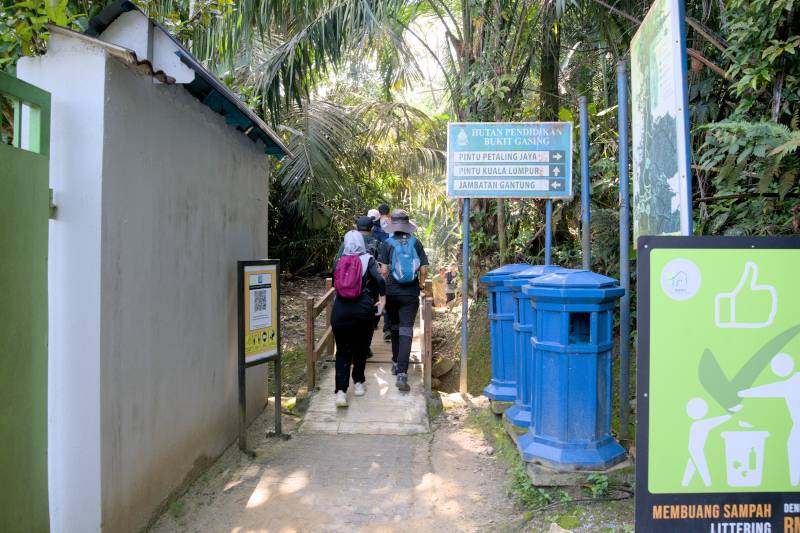
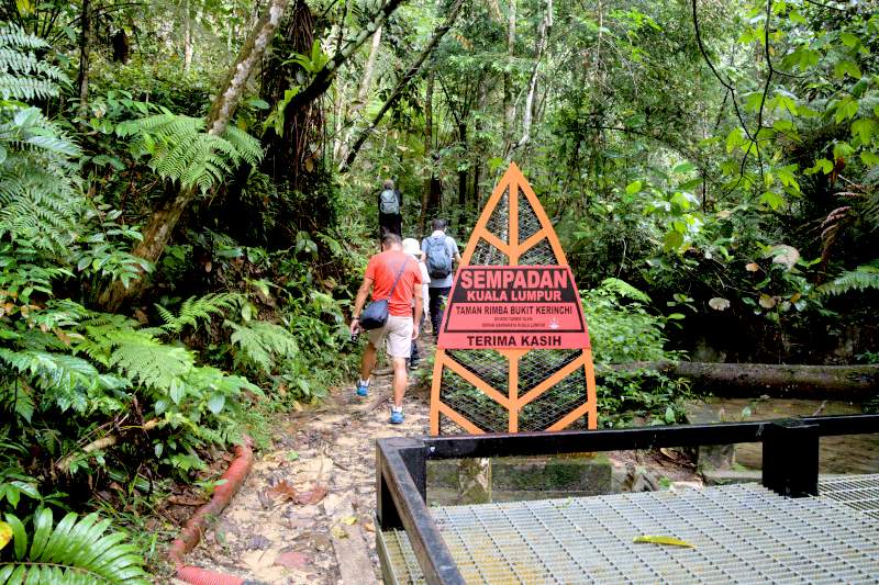
c. Entrance from Taman Rimba Bukit Kerinchi (GPS: 3.096630, 101.662852)
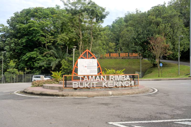

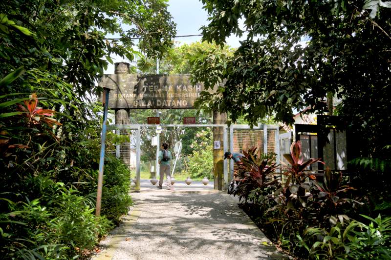
This is the official entrance, located on the opposite side of the hill from the Bukit Gasing entrance. There’s a large parking lot located next to the steel bridge.
There is a trail immediately after the steel bridge that leads into the forest park. If you don't want to use the bridge to enter, there is an alternate path you can take after passing a security checkpoint.
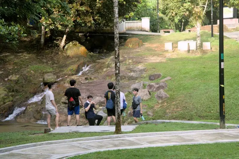
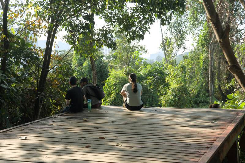
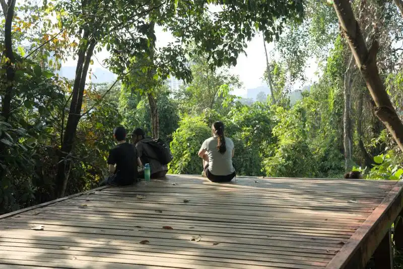
Inside the park is a garden-like area with benches, a gazebo, picnic spots, and a toilet. Recently refurbished, it charges a small fee to use.

d. Entrance from the suspension bridge (GPS: 3.1042591895141887, 101.65795988978425)

This entrance is located right beside the suspension bridge, adjacent to some bungalows. It's pretty inconvenient to use because there are no parking spaces or toilet facilities available. Parking here might also block residents' access.
However, if you've reached the suspension bridge during your hike and feel too tired to hike back to the main Bukit Gasing entrance, this exit can be helpful. Simply walk through the residential area to your left, and you'll eventually reach the Bukit Gasing entrance.
e. Entrance from the Indian Temple (GPS: 3.0920672844443646, 101.65868695996757)
The last entrance is near the Hindu temple, Maha Sivan Alayam. The trailhead is located a short walk from the temple, behind the TNB Bukit Gasing. It's not a very popular entrance, but many hikers use this as their endpoint when hiking from the main entrance to the Indian temple. Naturally, you can't park here, and there's no toilet nearby.
2. Places of Interest Inside Bukit Gasing
The highlight of the places of interest at various Bukit Gasing Hiking Trails as as below:
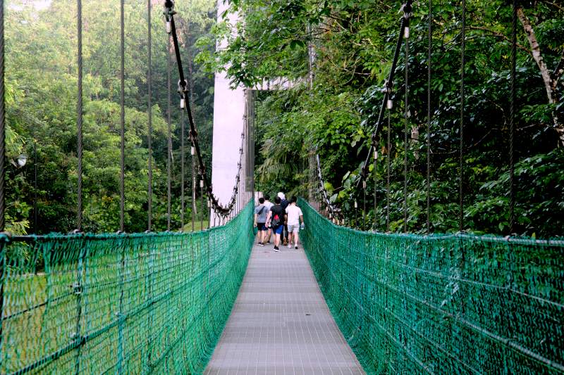
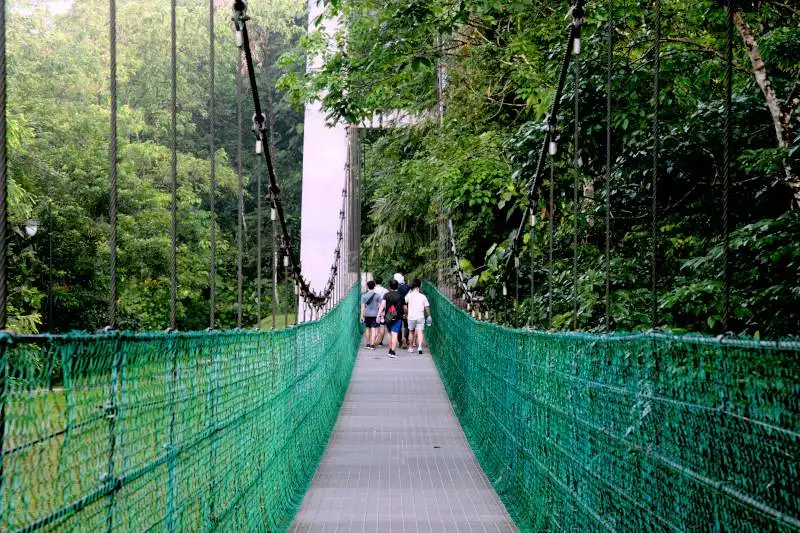
a. The Suspension Bridge
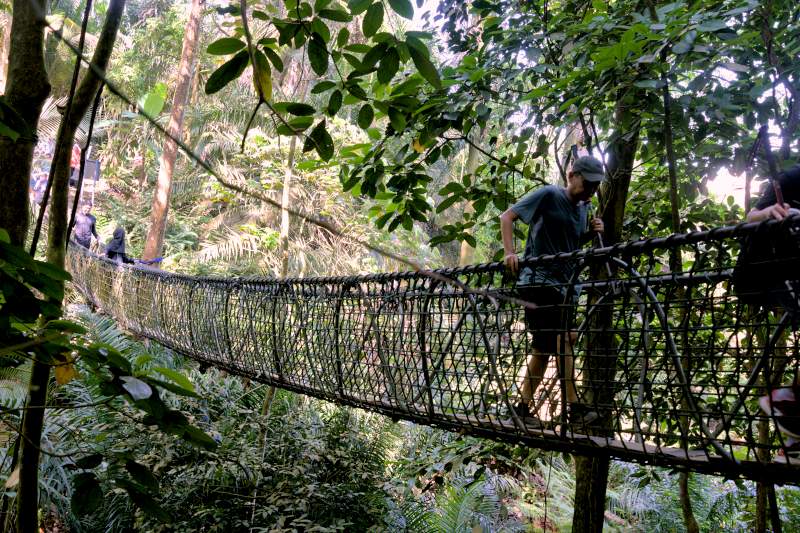
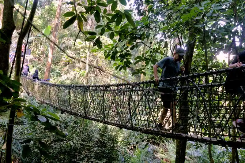
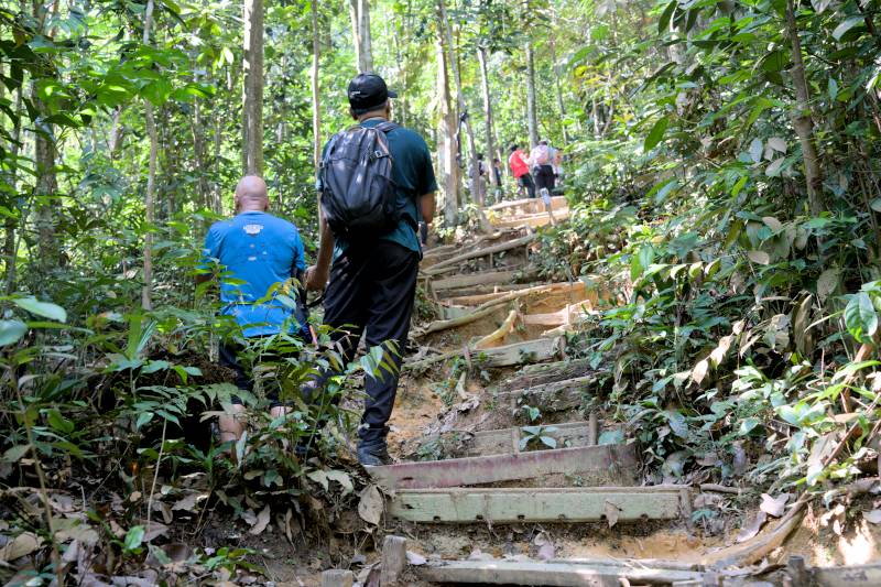
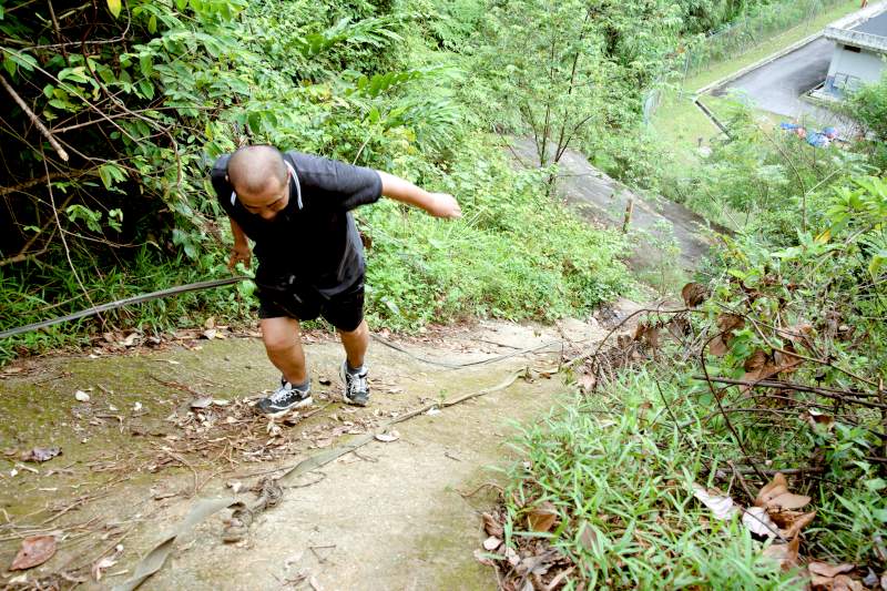
The most popular attraction at Bukit Gasing Forest Park is the suspension bridge. After crossing the bridge, you'll find the famous "killer stairs" – the "Stairway to Heaven" – featuring two small hills to climb. There's also a ravine you need to descend and a small stream to cross. This area is one of the best spots for hikers preparing for more challenging trails.
I've used this Stairway to Heaven route myself last year to train for my Annapurna Base Camp trek and am currently using it to prepare for my upcoming Everest Base Camp trek this October.
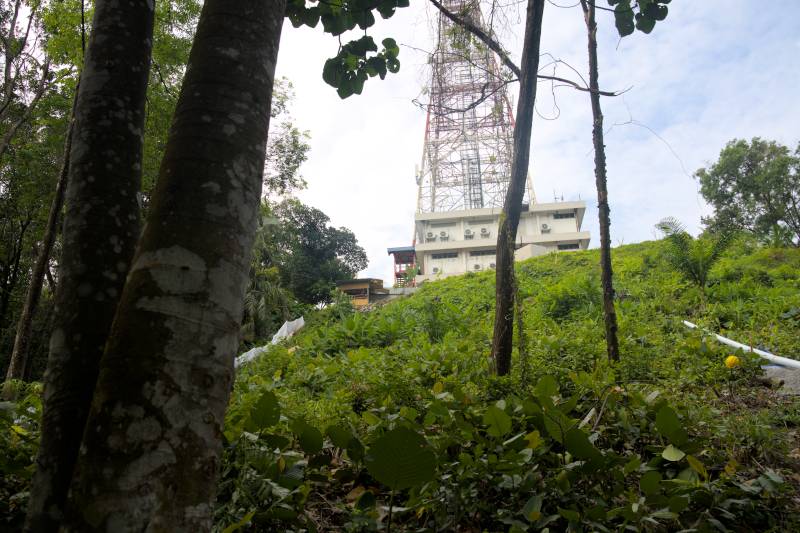
b. The Peak of Bukit Gasing
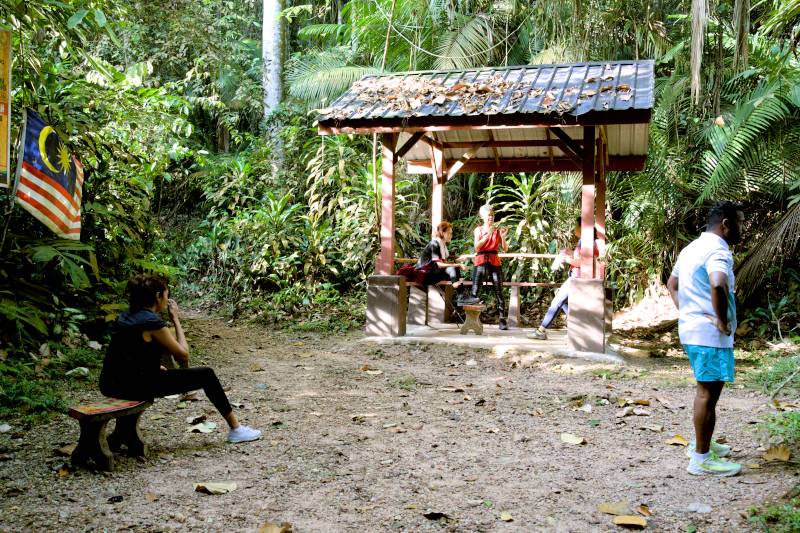
There's a small peak that's only about 160 meters above sea level. While not very high, it serves as a great vantage point and resting spot at the junction of several hiking trails. Here you'll find a platform that was once a watch tower, but now stands abandoned.
c. The Abandoned House

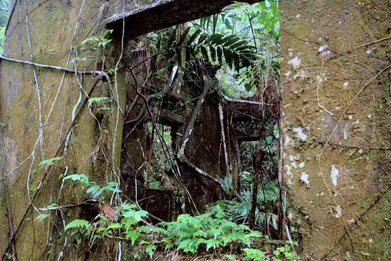
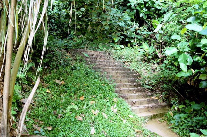
If you start your hike from the Bukit Kerinchi side, you'll first walk along a paved path. Shortly after leaving it, you'll come across an abandoned house. The building appears completely unused and has been deserted for many years. I'm not sure about its history or why it's there. If anyone knows the story behind this house, please share it in the comments!
d. The Stream
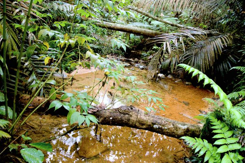
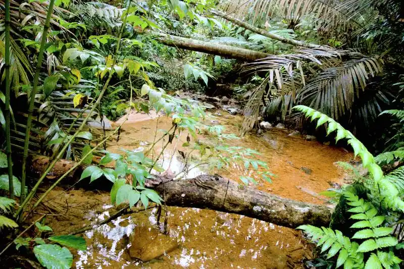
If you take the trail to the Indian Temple and then decide to return to the hill's peak (the watchtower area), you'll most likely use the Bukit Gasing Valley Trail for your return journey. Along this path, you'll eventually cross a small stream via a simple metal bridge—it's more of a metal plate than a proper bridge, but it keeps your feet dry.
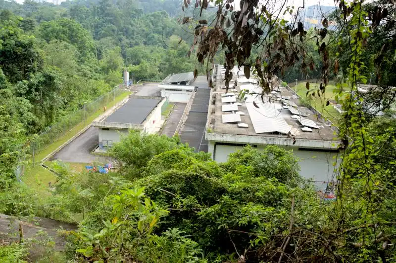
e. The Hindu Temple aand Syabas Reservoir
There’s a Hindu temple just outside the forest, and to get there, you’ll need to leave the jungle. As for the reservoir, it’s located right at the edge of the forest. You can reach it by walking along a narrow tarmac lane, which takes you out of the forest briefly before reentering through another trail. It’s not particularly spectacular, but it does serve as the final destination for a hiking trail that’s more challenging than the one leading to the suspension bridge.

3. Popular Bukit Gasing Hiking Trails
These trails offer a refreshing escape and are among the best ways to explore the lush greenery of Bukit Gasing Forest Reserve.
a. From the main entrance to the suspension bridge

This is the most popular hiking trail in Bukit Gasing. Today, I’ll be starting my hike from the Bukit Gasing entrance.
The trail is nicely paved right after the entrance—but that’s only for a short stretch, about 50 to 100 meters. Then it quickly transforms into a real forest trail.
Roughly 200 meters in, you’ll come to a intersection and a gazebo. To reach the suspension bridge, take the path on the left, which heads uphill.

The trail is mainly made up of multiple flights of stairs. Eventually, you’ll reach a viewpoint at the top. If you sit on the platform facing outward, the trail that leads to the suspension bridge will be right behind you.
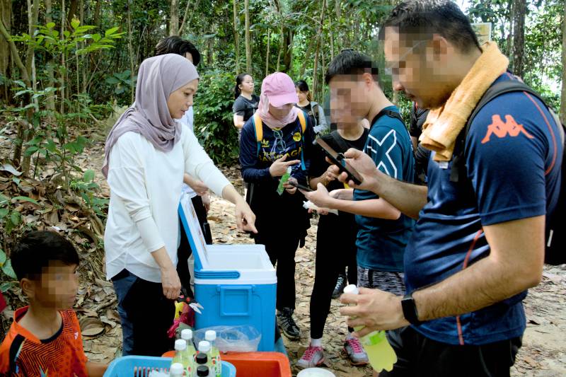
Not far from there, you’ll reach a popular junction where people usually sell ice cream and drinks in the mornings—especially on weekends.
To continue to the suspension bridge, take the left turn at that junction. Shortly after, you’ll come to another fork with benches and stools. Again, take the left turn and go straight for about 10 more minutes. That’ll bring you to your final destination—the suspension bridge.
After crossing the bridge, you’ll arrive at a place the locals call the "Stairway to Heaven." It’s a great spot to train your stamina, as there are two small peaks to climb. After the first peak, you’ll go downhill and cross a small stream before climbing the second one. The highest point on the trail— which is the second peak— isn’t very tall. It’s only 115 meters above sea level.
Once you’ve conquered that, keep walking downhill and you’ll end up back at the last junction before the suspension bridge. It’s basically a loop.
From there, I just retraced the same hiking trail back to the entrance. The total distance is slightly over five kilometers.
b. From the Bukit Kerinchi entrance to the junction to suspension bridge
The part before entering the jungle trail is a well-maintained path through the garden, with benches, gazebos, and picnic areas. There are a few entrances into the jungle trail — I took the one that’s just about a minute from the abandoned house, near the sign marking the border between Kuala Lumpur and Selangor.
From here, the trail eventually leads to the Kuala Lumpur side, where it merges with the junction heading towards the suspension bridge. I followed that path and eventually reached another junction, where people were selling ice cream and drinks, as I mentioned earlier.
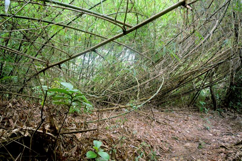
From there, I didn’t take the left turn towards the suspension bridge. Instead, I took the right path to return to the Kerinchi side using a different trail. The scenery over here is quite different, with bamboo bushes and a steep downhill section that’s pretty slippery.
The trail eventually leads us back to the recreational park, right at the starting point of the steel bridge.
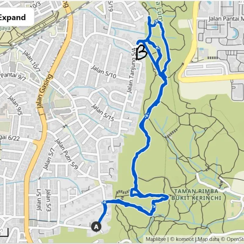
c. From the Bukig Gasing main entrance to the Maha Sivan Alayam Temple and Syabas reservoir
Besides the suspension bridge trail, there's another, less popular trail that leads you to the Indian temple. If you enter from the main entrance of Bukit Gasing, keep to the right, and you’ll find a set of trails that lead to the temple as well as the Syabas Reservoir.
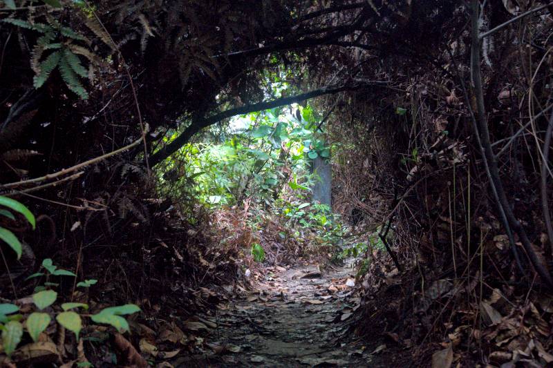
This trail is less popular compared to the one leading to the suspension bridge. There are also fewer people using it, so the paths are narrower and less clearly marked. The trail also includes more uphill sections, making it a bit challenging for beginners.
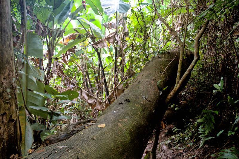
When I was there, several fallen trees blocked the path, and I had to climb over them to continue. The trail eventually led me to the temple, but I didn’t exit through it. Instead, I followed the path all the way to the Syabas Reservoir.
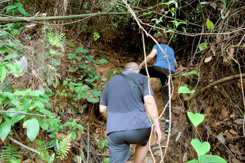
I walked along the fence of the reservoir and later re-entered the jungle, where the climb became steep.
At one point, I had to hold onto a rope to get up. After that, I walked on tarmac again before entering the jungle once more and finally returned to the starting point.
4. Facilities
a. Parking Areas
As I mentioned earlier, the official parking areas are at both the Bukit Gasing and Bukit Kerinchi entrances. There is no parking fee. The only issue is that spaces are quite limited, especially on weekend mornings. Since there is no public transportation to this area, driving your car remains the most practical option.
b. Toilet and Washing Area
I strongly recommend everyone use the official entrances (Bukit Gasing and Bukit Kerinchi), as they offer proper parking and toilet facilities. Just remember: once you begin your hike, there are no toilets along the trails. The toilet at Bukit Gasing is free, while the one at Bukit Kerinchi charges RM0.20 per entry. You can pay with Touch 'n Go.
c. Internet
The internet signal in Bukit Gasing is generally quite strong. This means your trail app should work fine even without downloading offline maps. Because of this reliable connectivity, I find it quite safe to hike here—especially when using a hiking app.
d. Resting Area and Shelter
Along certain parts of the trail, you'll find resting areas—some with shelters. Several gazebos are also available, where hikers can sit down to relax or enjoy snacks. However, please note that these spots don't have toilet facilities or a water supply.
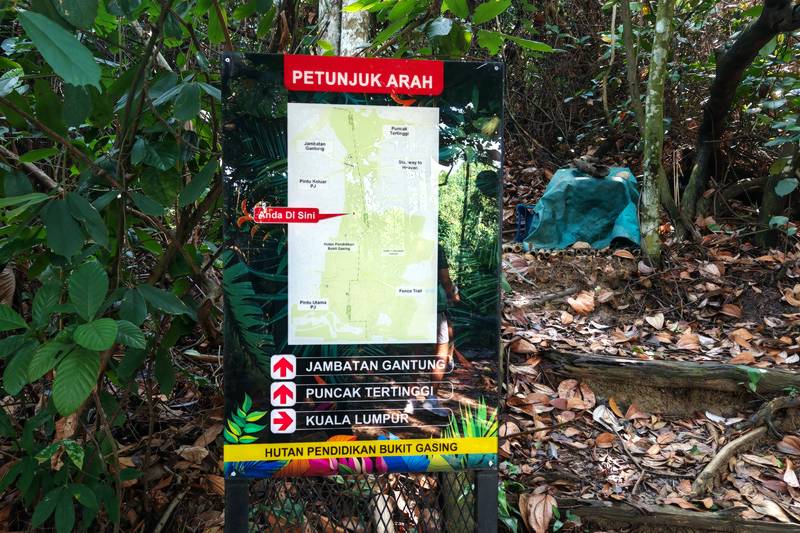
e. Signboard and Map
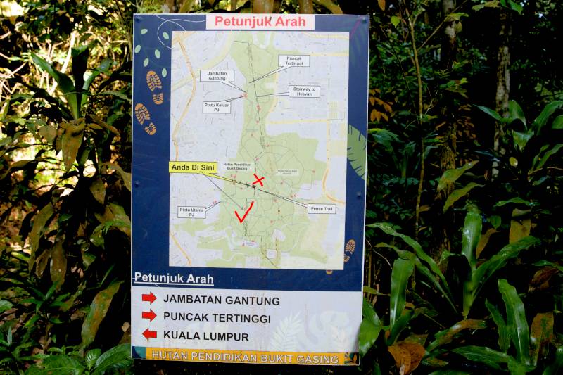
Trail maps along the trail show directions, but unfortunately, the arrows don't always clearly indicate the exact path and can be confusing at times. Maps are also available, though most contain errors.
f. Food and Drink
There are no permanent food stores along the trails. However, at certain trail intersections, you might occasionally find vendors selling cold drinks and ice cream. This isn't a regular occurrence, though—they typically only come during peak hours, such as weekend mornings.
5. Things to Bring for the Hike
- Please bring enough drinking water, as there are no stores in this area that sell water. Since most of the trails are relatively short and you’ll likely only hike for half a day, 500 to 1000 milliliters of water should be sufficient.
- It is also highly recommended to apply insect repellent, as there are many mosquitoes.
- A good pair of walking shoes, preferably hiking shoes, is essential. Some trails can be pretty steep and slippery at certain sections.
- I would suggest bringing an extra shirt to change after your hike, as you’ll probably sweat a lot.
- If you’re not entirely confident in your physical fitness, bring a hiking pole—it can be very helpful.
- Although it’s unlikely you’ll get lost in Hutan Pendidikan Bukit Gasing, I still recommend using a trail app like AllTrails or Komoot. These apps display trail names that won’t appear on Google Maps. While hiking, they also track your distance, so if you do get lost, you can follow the recorded path back to your starting point.
6. Best Time to Hike at Bukit Gasing
In my opinion, the best time to take on any Bukit Gasing Hiking Trails is always in the morning, as it’s not as hot. As for the best day of the week, there are usually a lot of people on holidays and weekends. If you don’t mind the crowds, it can be a great time to hike and interact with others. Otherwise, you can come (if you’re free) on weekdays when there are far fewer people.
The only downside to hiking on weekends is that parking can be tricky—you might have to park farther away from the trailhead. Also, always check the weather forecast before heading out.
Opening Hours:
There aren’t any official opening hours for Bukit Gasing Forest Park trails, but it’s advisable not to hike too late. I’d recommend finishing your hike before 4:00 PM, no matter what. This way, you avoid being caught in the dark, which could make you nervous and make it harder to find your way back.
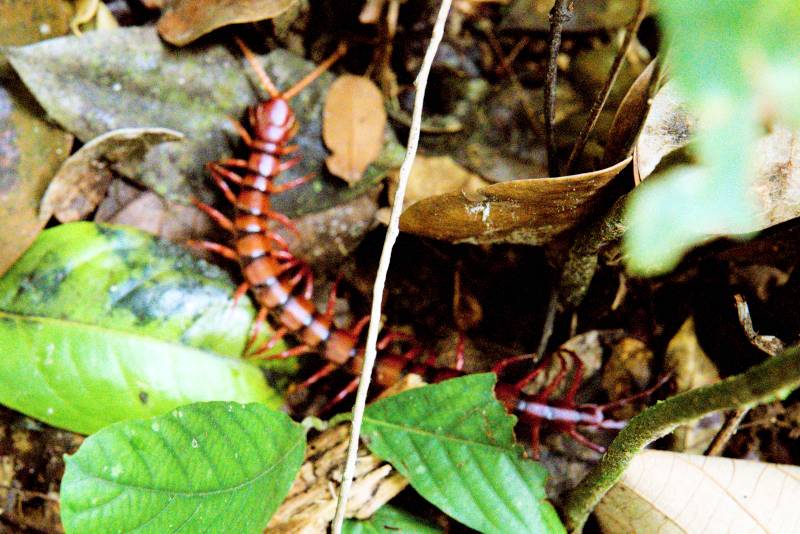
7. Will There Be Any Animals?
I have hiked at this place many times, and the only animals you’ll encounter are monkeys and squirrels. There are plenty monkeys here. If you bring food, be cautious and keep it out of sight, as the monkeys might snatch it right from your hands. I once saw this happen to a hiker right in front of me.
I haven’t seen any other animals besides monkeys, but be aware of potentially poisonous insects. On the bright side, there are no leeches here.
8. About Bukit Gasing
Bukit Gasing was once a rubber plantation during the early 20th century, under the colonial era. However, due to urbanization and fluctuating rubber prices, the rubber estate was eventually abandoned and gradually regenerated into the secondary forest we see today.
Officially known as Bukit Gasing Forest Park, it serves two primary purposes: conserving green lungs and providing a public recreational area. Two different local authorities uniquely manage the park. Petaling Jaya City Council (MBPJ) oversees the Selangor side. Kuala Lumpur City Hall (DBKL) manages the KL side.
9. 🎞️ Watch our video at Bukit Gasing
Please watch the video we shot at various Bukit Gasing Hiking Trails.